Building car-dependent neighbourhoods

Also published on Resilience

Car-dependent neighbourhoods arise in a multi-level framework of planning, subsidies, advertising campaigns and cultural choices. After that, car dependency requires little further encouragement. Residents are mostly “locked-in”, since possible alternatives to car transport are either dangerous, unpleasant, time-consuming, or all three.

At the same time, municipal officials have strong incentives to simply accept car dependency – it takes bold new thinking to retrofit such neighbourhoods. Voters are likely to resist such new directions, since it is hard for them to imagine making their daily rounds using anything except private cars.

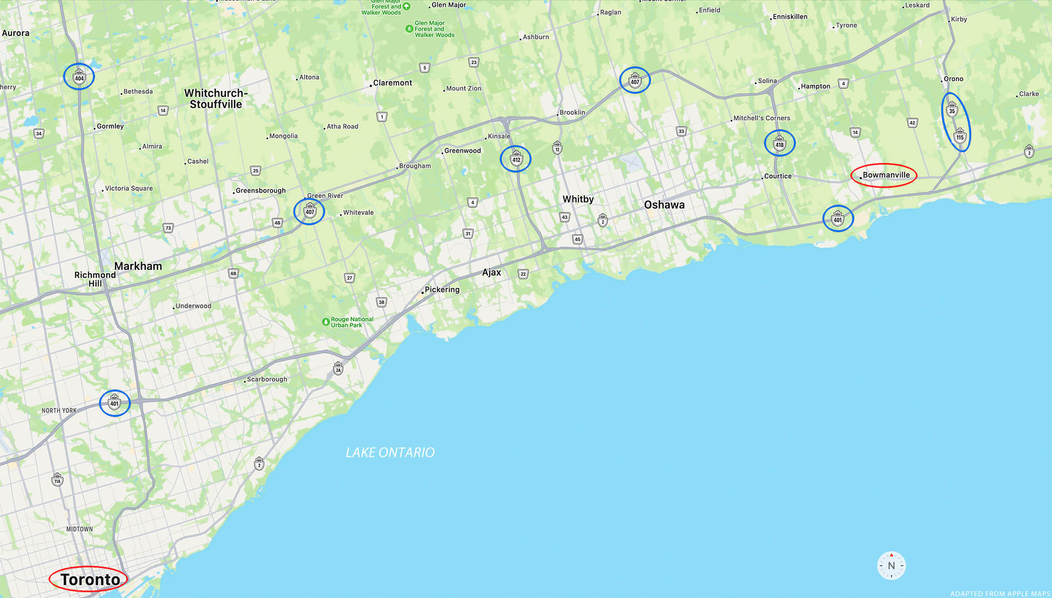
This post continues a discussion of what car dependency looks like on the map. The previous installment looked at car dependency on a regional scale, while this one looks at the neighbourhood scale.

Both posts use examples from Durham Region, a large administrative district on the east flank of Toronto. With a current population of about 700,000, Durham Region is rapidly suburbanizing.

I’ve picked one neighbourhood to illustrate some common characteristics of car-dependent sprawl. I have chosen not to name the neighbourhood, since the point is not to single out any specific locale. The key features discussed below can be seen in recent suburban developments throughout Durham Region, elsewhere in Ontario, and around North America.

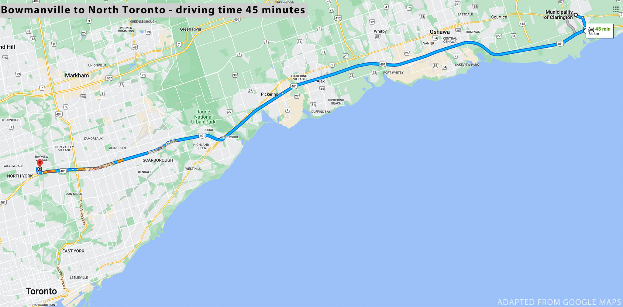
Let’s begin to zoom in. In the aerial view below you can see new subdivisions creeping out towards a new expressway. Brown swatches represent farmland recently stripped of topsoil as the first step in transforming rich agricultural land into suburban “development”. (In the short time since this aerial imagery was obtained, the brown swatches have become noticeably more extensive.)

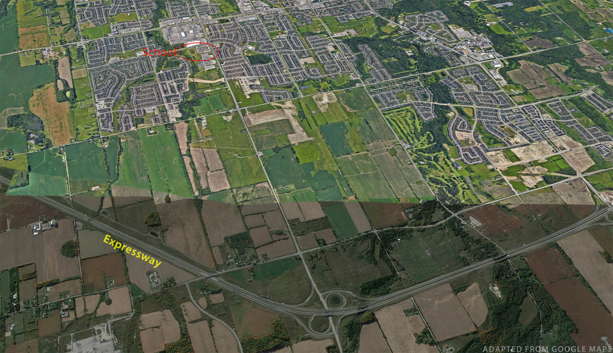
The neighbourhood we’ll focus on includes a high school, conveniently identifiable by its distinctive oval running track.

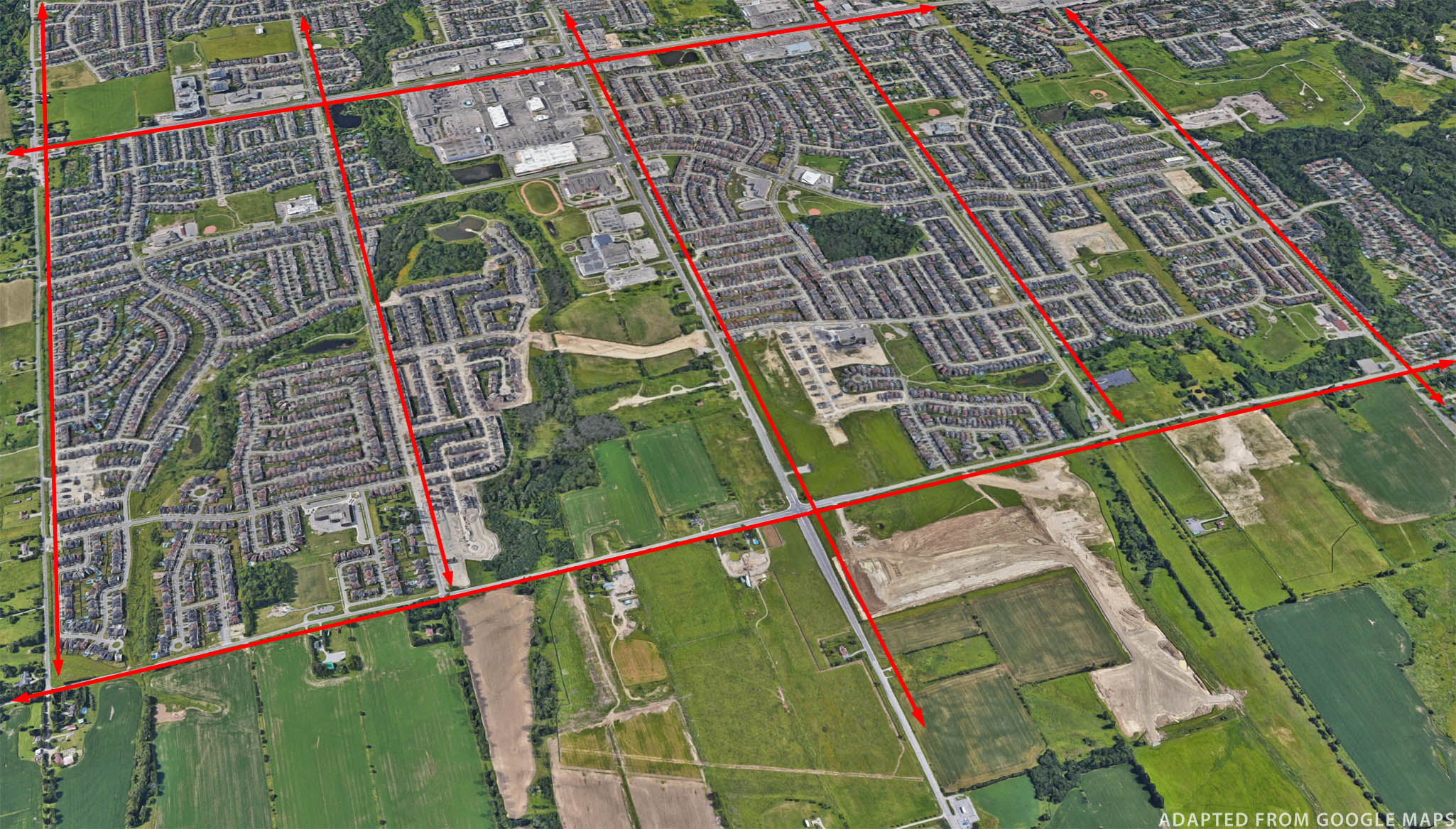
Subdivisions here are built in a megablock layout, with the large-scale grid intended to handle most of the traffic. Within each megablock is a maze of winding roads and lots of dead-ends. The idea is to discourage through traffic on residential streets, but this street pattern has many additional consequences.

First, from the centre of one megablock to the centre of another nearby megablock, there is seldom a direct and convenient route. A trip that might be a quarter of a kilometer as the crow flies might be a kilometer or two as the car drives. In the worst areas, there are no available short cuts for cyclists or pedestrians either.

Second, the arterial roads need to be multilane to cope with all the traffic they collect – and as “development” proceeds around them they are soon overwhelmed. “Recovering engineer” Charles Marohn explains this phenomenon using an analogy from hydrology. At a time of heavy rain, a whole bunch of little streams feed into progressively larger streams, which soon fill to capacity. With a pattern of “collector” roads emptying into secondary arterial roads into primary arterials and then into expressways, suburban road systems manage to engineer traffic “floods” each time there is a “heavy rain” – that is, each morning and afternoon at rush hour.1

As we zoom in to our high school’s neighbourhood, note another pattern repeated throughout this region. Within a residential neighbourhood there may be a row of houses close to and facing an arterial road. Yet these houses are on the equivalent of a “service road” rather than having direct access to the arterial. For motorists living here the first stage of a journey, to the arterial road just 50 meters from their driveway, requires driving ten times that far before their journey can really begin. Though the maze pattern is intended to limit traffic in such neighborhoods, residents create a lot of traffic simply to escape the maze.

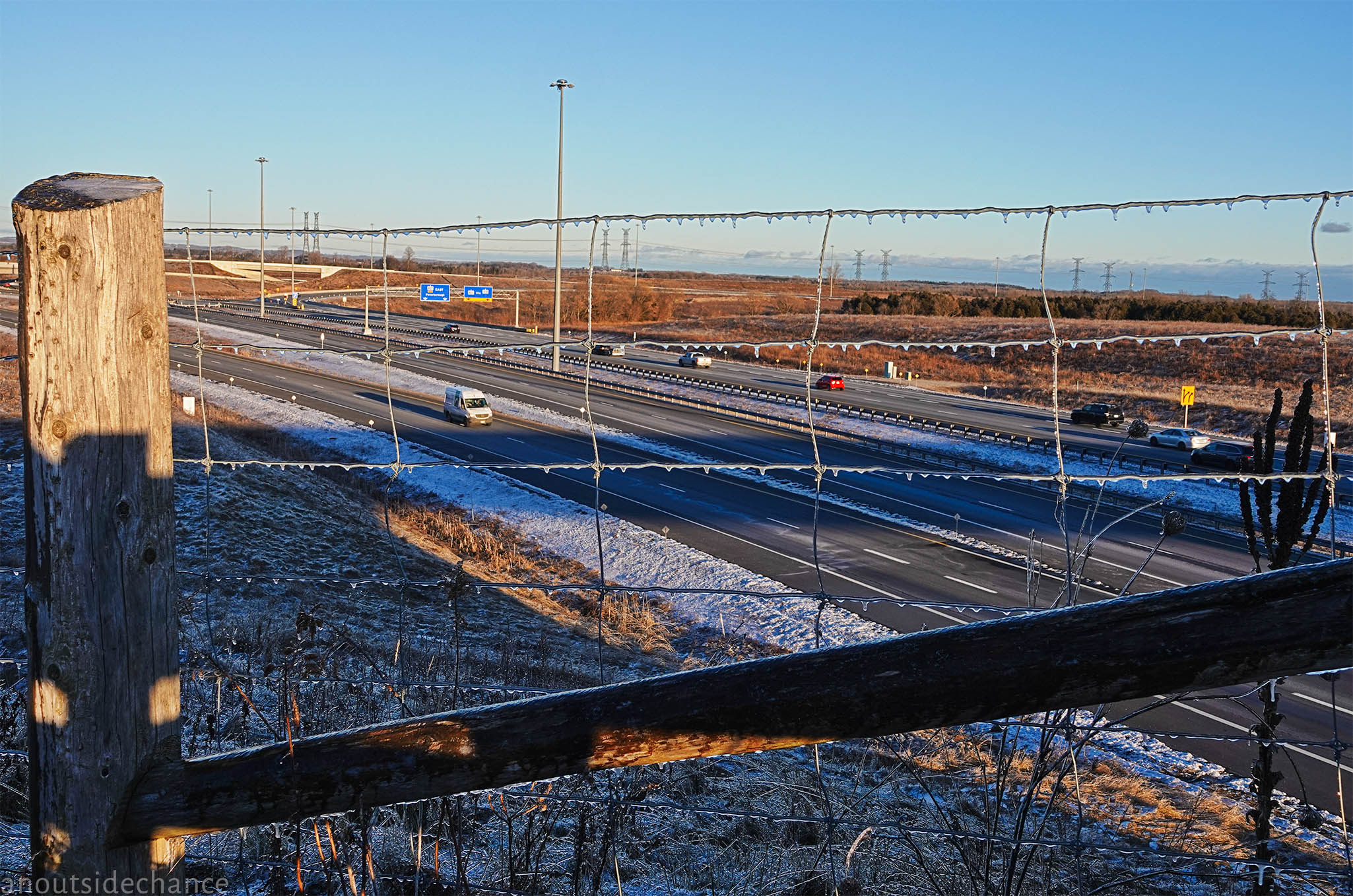
The residential service road pattern has the effect of making arterial roads into semi-controlled-access roads. As seen in this example, there are few driveways or other vehicle entry points in long straight stretches of such an arterial. This design encourages drivers to drive well above the posted 60 km/hr speed limit … whenever the road is not clogged with rush-hour traffic, that is.

High traffic speeds make crossing such roads a dangerous undertaking for pedestrians and cyclists. True, there are some widely-spaced authorized crossing points, with long waits for the “walk” light. But when getting to and waiting at a crosswalk is not convenient, some people will predictably take their chances fording the rushing stream at other points. How many parents will encourage or even allow their children to walk to school, a playground, or a friend’s house if the trip involves crossing roads like these?

Just across the road. High school is on the left of the road, residential neighbourhood to the right.

Pedestrian access is at best a secondary consideration in such developments. Consider the aerial view below.

Directly across one arterial road from the high school, and across another arterial from a residential neighbourhood, is a cluster of big box retail stores including a Walmart Supercentre. The Walmart has 200 meters of frontage on the street, but in that stretch there is no entrance, nothing but concrete wall to greet the occasional lonesome pedestrian.

From another direction, many people live “just across the street” from the Walmart and other stores. Except … would-be pedestrian shoppers will need to cross not just a multilane urban highway, but also hectares of parking lot, before reaching the doors of a store. These stores are large in retail floor area, but they are dwarfed by the land given to parking. In accord with minimum parking requirements, the stores have spent hundreds of thousands of dollars to provide “free parking”. But there is no requirement to take the convenience of pedestrians into account. The doors open to the parking lots, not to the streets, because the vast majority of shoppers will arrive in large private vehicles that will need to be stored somewhere while the owner goes shopping.

Nevertheless there will be a small minority in such neighbourhoods who get to the store on foot or on bike. A few might be brave, stubborn environmentalists or exercise freaks. But mostly they will be people who can’t afford a car, or who can’t drive because of some type or degree of disability. Disproportionately, they will be elderly and/or in poor health. Particularly when carrying heavy bags of groceries, they will not want to go far out of their way to get to a crosswalk, preferring instead to make the shortest straightest trip home. It is not an accident that high-volume arterial roads in suburbs account for a large proportion of pedestrian deaths in North American cities. It is not an accident, either, that a disproportionate number of these deaths are inflicted on elderly, disabled, poor, or racially disadvantaged pedestrians.2

Lamp posts

Out beyond the beyond

It is now widely recognized that car-dependent suburbia hurts public health via an increase in diseases of sedentary lifestyle and due to the stress of spending many hours a week in alternately frenetic and creeping traffic.3 The environmental costs of sprawl include high carbon emissions, impermeable ground covering that rapidly flushes polluted run-off into diminishing areas of creeks and wetlands, and urban heat-island effects from so much concrete and asphalt. Particularly in Ontario, new tracts of car-dependent sprawl can only be built with the sacrifice of increasingly scarce class one farmland.4 Finally, groups such as Strong Towns have documented the long-term fiscal disaster of suburban development.5 Even though higher levels of government typically pay much of the initial cost of major infrastructure, municipalities will be on the hook for maintenance and eventual rebuilding – and property taxes in low-density suburbs seldom bring in enough revenue to cover these steadily accruing liabilities.

Yet in Ontario the large property developer lobby remains as strong a political force as ever. The Premier of Ontario makes no real attempt to hide his allegiance to the largest property developers.6 In Durham Region, after a long public consultation process recommended intensification of existing urban areas to accommodate growing populations, politicians suddenly voted instead for a sprawl-expanding proposal put forward by the development industry lobby.7

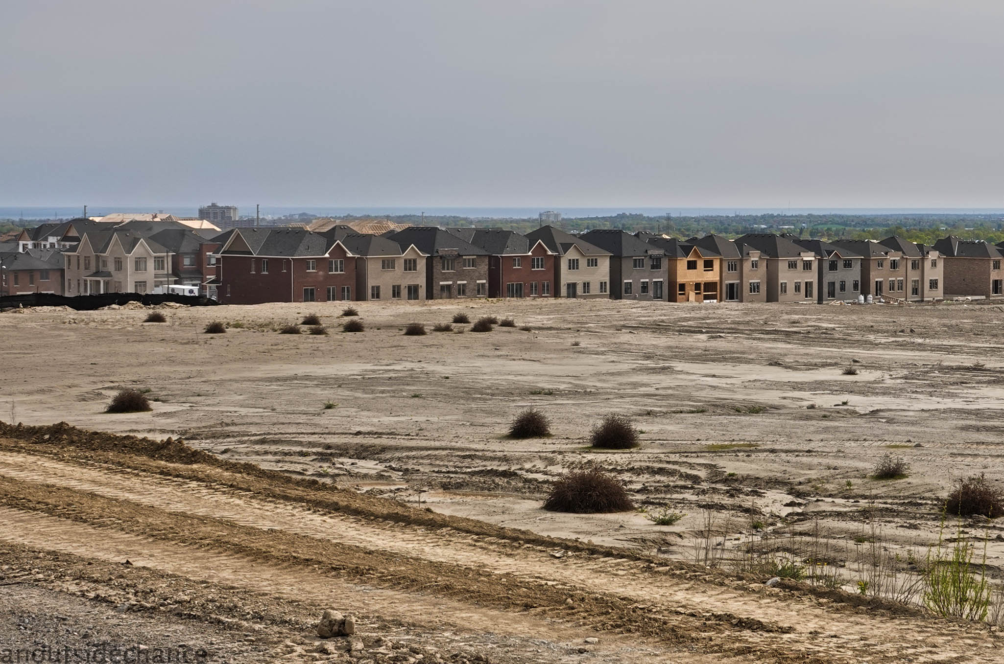
So in 2023, corn fields and pastures beyond the current edge of suburbia are being bulldozed, new maze-like streets laid out, thousands of big, cheaply-made, dearly-purchased, cookie-cutter houses stuffed into small lots. For a brief period new residents can look through the construction dust and see nearby farmland or woodland – until the edge of suburbia takes the next step outward.

Suppose you believe, as I do, that this ruinous pattern of development should not and cannot last – that this pattern will not survive past the era of cheap energy, and will not survive when its long-term fiscal non-sustainability results in collapsing services and municipal bankruptcies. When car culture sputters, falters and runs off the road, can these thousands of neighbourhoods, home to millions of people, be transformed so they are no longer car dependent? That’s a big question, but the next post will offer a few ideas.

For today, the edge


Image at top of page: Bulldozertown (click here for full-screen image). All photos used here are taken in the same area shown in satellite views.


Notes

Charles Marohn, Confessions of a Recovering Engineer, Wiley, 2021; pages 85–87.

For analyses of trends in pedestrian deaths, see Angie Schmitt’s 2020 book Right of Way (reviewed here), and Jessie Singer’s 2022 book There Are No Accidents (reviewed here).

See “Suburbs increasingly view their auto-centric sprawl as a health hazard,” by Katherine Shaver, Washington Post, December 28, 2016.

“Ontario losing 319 acres of farmland every day,” Ontario Farmland Trust, July 4, 2022.

See “The Growth Ponzi Scheme: A Crash Course,” by John Pattison, strongtowns.org.

See The Narwhal, “Six developers bought Greenbelt land after Ford came to power. Now, they stand to profit,” November 17, 2022; BlogTO, “All the crazy details about Doug Ford’s controversial stag and doe party with developers,” February 9, 2023.

See The Narwhal, “Ontario’s Durham Region approves developer-endorsed plan to open 9,000 acres of farmland,” May 26, 2022.

Recipes for car dependency

Also published on Resilience

A car-dependent society isn’t built overnight. It takes concerted effort by multiple levels of government and industry to make private cars the go-to, all-but-obligatory choice for everyday personal transportation.

If you want to see what car dependency looks like on a map, you need to look at a regional or neighbourhood scale. You need to see the options people have for the kind of trips they make on a routine, everyday basis.

This series looks at the layout of car dependency in my part of Ontario, Canada.

Durham Region is an administrative district on the east flank of Toronto. The Region covers about 2500 square kilometers, but most of the current population of about 700,000 lives in the southern communities bordering Lake Ontario.

As shown below, there is an extensive network of expressways and major arterial roads connecting Durham Region with itself and with the rest of the Toronto megalopolis. Two east-west expressways cross Durham Region, two north-south expressways cover part of the Region, and there are dozens other highways and major arterials.

A region-scale map. The roads with signs circled in blue are multi-lane, controlled-access highways. Other roads shown in grey are major arterials. Downtown Bowmanville and downtown Toronto are about 75 kilometers apart.

The passenger-rail network, on the other hand, is terribly sparse.

Passenger rail routes through Durham Region, shown in thin blue lines.

One commuter rail line runs east from Union Station in downtown Toronto. It currently terminates in Oshawa, though an extension as far as Bowmanville is promised in a few years. (It’s been promised “in a few years” for more than a few years.) A long-distance line, Via Rail, passes through Bowmanville but does not stop. That means rail travel is not a realistic option for most Durham residents, most of the time, in most directions.

It wasn’t always this way. The passenger rail network was much more extensive a hundred years ago. Though I haven’t found a good map of regional rail lines in the 1920s, there is one from about 50 years earlier:  1875.

Ontario railways constructed or chartered in 1875. Image via Wikimedia Commons.

As shown below, in 1875 Durham Region residents already had not just an east-west connection to Toronto, but two passenger rail lines running north-south through the region. Other lines had been chartered and some were actually built and in operation by the early twentieth-century, though they are a faded historical memory today.

There are many reasons society might have chosen to fund extensive networks of highways, while letting rail networks wither and die. But two powerful industrial lobbies benefitted when passenger rail was eclipsed in favour of private cars. The consumption of liquid fossil fuels rose steeply with the ascent of car culture, to the benefit of Canada’s still large and still influential petroleum industry. And at the provincial level, “by the early 2000s Ontario had become the largest auto-producing jurisdiction in North America.”1

Widespread car dependency is now taken for granted in Durham Region – except by the minority who are either unwilling or unable to get into a car every day. We can illustrate why with the aid of a few more maps.

Living right next to a city about the size of Chicago, in a metroplex of some 7.2 million people, many residents of Durham Region commute to work somewhere in Toronto or its suburbs. For most of these commuters public transit is an unattractive choice.

A major commuter rail line, the GO Train, does connect southern parts of Durham Region to downtown Toronto at Union Station. For those who work near Union Station or one of the other stations, the GO Train may be a great commuting option. For all others, public transit gets more complicated and less attractive.

Consider commuting to what is called “north Toronto” – an area now pretty much in the center of the megalopolis. This area is a typical commuting destination for Durham residents. As the map below shows, the trip is straightforward and relatively quick by car.

Driving from downtown Bowmanville to north-central Toronto, a distance of 64 km, takes about 45 minutes.

To make the same trip by public transit, you need to check schedules carefully and hope your connecting routes run at the hours you need them. Plus, you need to allow 2 to 2.5 hours for the trip that could be done by car in 45 minutes.

Taking public transit from downtown Bowmanville to north-central Toronto takes a minimum of 2 hours. Some of the routes run at reduced frequencies on weekends/holidays, and do not operate late at night.

Let’s look at another, shorter, trip. Ontario Tech University is the only university whose main campus is in Durham Region. Suppose you need to go from downtown Bowmanville to the Ontario Tech campus in Oshawa – just 22 or 23 kilometers. It’s easy by car:

But again, you need to budget more than twice as much time to go by transit:

For these and countless comparable inter-region trips, existing infrastructure and services put tremendous pressure on people who travel by transit. They might consider moving to a residence much closer to their destination – but housing costs are more astronomical the closer you go to Toronto. They might look for a different job or choose schooling closer to home – even if that means settling for a second or third choice. More likely, they might start saving for a car so they can become part of the traffic. And if none of these are possible, they need to devote a large chunk of each day to their commute.

Car dependency takes more than one generation to build – but it’s not always easy to escape.

Stalled in the 1950s

A curious video advertisement was produced for General Motors in 1954. Most ads for car companies show their products cruising along scenic and empty highways. But “Give Yourself the Green Light” took a very different tack: it showed motorists sweating in stalled or crawling traffic, on roads packed with other equally frustrated motorists. In this case GM wasn’t selling cars, at least not directly – they were selling more roads. Specifically, the video was part of an intensive lobbying campaign to persuade voters and car consumers to support massive government expenditures for more and wider highways.2

That expanded highway construction effort still continues almost 70 years later. The roads have gobbled up vast tracts of land and vast sums of tax dollars, but haven’t vanquished the dreaded rush hour traffic tie-ups. Today, rush hours are much longer than an hour, and extend much farther out from city centers, through suburbs and exurbs.

But the current government of Ontario, led by Premier Doug Ford, remains under the spell of that 1950s vision of endless, wide, and free-flowing highways. True, they are now budgetting for and planning major, long-overdue subways and commuter rail expansions in the most crowded parts of the Greater Toronto Area. Perhaps they recognize there simply is no room for wider roads in those areas, and so the only way to reduce congestion is to give more drivers a way to leave their cars at home.

At the edges of urban sprawl it’s another story. Far out from the center of Toronto, where there are still no good public transit options, the Premier is pushing hard to build two more expressways along the north and north-west edges of the metro area. These highly controversial routes, if constructed, will augment ultra-expensive privately run toll road Highway 407, recently extended through Durham Region.

These expressways do more than eat up large amounts of space – which happens to be some of the best scarce farmland in Canada – for travel lanes, medians and interchanges. They also facilitate and encourage equally space-hungry housing forms and commercial developments – developments which will need abundant parking since driving will be the only way to get to and from them.

In the next installment we’ll examine car-dependent development patterns at the neighbourhood level, along with the provincial and regional policies that continue to promote this pattern.


Photo at top of page: Restricted Access – Highway 407 toll route in northeast Durham Region, photographed on Feb 17, 2023. Full-screen image here.


Footnotes

1 The Canadian Encyclopedia, “Automotive Industry”.

The superb series Not Just Bikes includes many excerpts from the GM video along with commentary by vlogger Jason Slaughter, in the recent installment “Would You Fall For It?”

How parking ate North American cities

Also published on Resilience

Forty-odd years ago when I moved from a small village to a big city, I got a lesson in urbanism from a cat who loved to roam. Navigating the streets late at night, he moved mostly under parked cars or in their shadows, intently watching and listening before quickly crossing an open lane of pavement. Parked cars helped him avoid many frightening hazards, including the horrible danger of cars that weren’t parked.

The lesson I learned was simple but naïve: the only good car is a parked car.

Yet as Henry Grabar’s new book makes abundantly clear, parking is far from a benign side-effect of car culture.

The consequences of car parking include the atrophy of many inner-city communities; a crisis of affordable housing; environmental damages including but not limited to greenhouse gas emissions; and the continued incentivization of suburban sprawl.

Paved Paradise is published by Penguin Random House, May 9, 2023

Grabar’s book is titled Paved Paradise: How Parking Explains the World. The subtitle is slightly hyperbolic, but Grabar writes that “I have been reporting on cities for more than a decade, and I have never seen another subject that is simultaneously so integral to the way things work and so overlooked.”

He illustrates his theme with stories from across the US, from New York to Los Angeles, from Chicago to Charlotte to Corvallis.

Paved Paradise is as entertaining as it is enlightening, and it should help ensure that parking starts to get the attention it deserves.

Consider these data points:

  • “By square footage, there is more housing for each car in the United States than there is housing for each person.” (page 71; all quotes in this article are from Paved Paradise)
  • “The parking scholar Todd Litman estimates it costs $4,400 to supply parking for each vehicle for a year, with drivers directly contributing just 20 percent of that – mostly in the form of mortgage payments on a home garage.” (p 81)
  • “Many American downtowns, such as Little Rock, Newport News, Buffalo, and Topeka, have more land devoted to parking than to buildings.” (p 75)
  • Parking scholar Donald Shoup estimated that in 1998, “there existed $12,000 in parking for every one of the country’s 208 million cars. Because of depreciation, the average value of each of those vehicles was just $5,500 …. Therefore, Shoup concluded, the parking stock cost twice as much as the actual vehicles themselves. (p 150)

How did American cities come to devote vast amounts of valuable real estate to car storage? Grabar goes back to basics: “Every trip must begin and end with a parking space ….” A driver needs a parking space at home, and another one at work, another one at the grocery store, and another one at the movie theatre. There are six times as many parking spaces in the US as there are cars, and the multiple is much higher in some cities.

This isn’t a crippling problem in sparsely populated areas – but most Americans live or work or shop in relatively crowded areas. As cars became the dominant mode of transportation the “parking problem” became an obsession. It took another 60 or 70 years for many urban planners to reluctantly conclude that the parking problem can not be solved by building more parking spaces.

By the dawn of the twenty-first century parking had eaten American cities. (And though Grabar limits his story to the US, parking has eaten Canadian cities too.)

Grabar found that “Just one in five cities zoned for parking in 1950. By 1970, 95 percent of U.S. cities with over twenty-five thousand people had made the parking spot as legally indispensable as the front door.” (p 69)

The Institute of Transportation Engineers theorized that every building “generated traffic”, and therefore every type of building should be required to provide at least a specified number of parking spaces. So-called “parking minimums” became a standard feature of the urban planning rulebook, with wide-ranging and long-lasting consequences.

Previously common building types could no longer be built in most areas of most American cities:

“Parking requirements helped trigger an extinction-level event for bite-size, infill apartment buildings …; the production of buildings with two to four units fell more than 90 percent between 1971 and 2021.” (p 180)

On a small lot, even if a duplex or quadplex was theoretically permitted, the required parking would eat up too much space or require the construction of unaffordable underground parking.

Commercial construction, too, was inexorably bent to the will of the parking god:

“Fast-food architecture – low-slung, compact structures on huge lots – is really the architecture of parking requirements. Buildings that repel each other like magnets of the same pole.” (p 181)

While suburban development was subsidized through vast expenditures on highways and multi-lane arterial roads, parking minimums were hollowing out urban cores. New retail developments and office complexes moved to urban edges where big tracts of land could be affordably devoted to “free” parking.

Coupled with separated land use rules – keeping workplaces away from residential or retail areas – parking minimums resulted in sprawling development. Fewer Americans lived within safe walking or cycling distance from work, school or stores. Since few people had a good alternative to driving, there needed to be lots of parking. Since new developments needed lots of extra land for that parking, they had to be built further apart – making people even more car-dependent.

As Grabar explains, the almost universal application of parking minimums does not indicate that there is no market for real estate with little or no parking. To the contrary, the combination of high demand and minimal supply means that neighbourhoods offering escape from car-dependency are priced out of reach of most Americans:

“The most expensive places to live in the country were, by and large, densely populated and walkable neighborhoods. If the market was sending a signal for more of anything, it was that.” (p 281)

Is the solution the elimination of minimum parking requirements? In some cases that has succeeded – but reversing a 70- or 80-year-old development pattern has proven more difficult in other areas. 

Resident parking on Wellington Street, South End, Boston, Massachusetts. Photo by Billy Wilson, September 2022, licensed through Creative Commons BY-NC 2.0, accessed at Flickr.

The high cost of free parking

Paved Paradise acknowledges an enormous debt to the work of UCLA professor Donald Shoup. Published in 2005, Shoup’s 773-page book The High Cost of Free Parking continues to make waves.

As Grabar explains, Shoup “rode his bicycle to work each day through the streets of Los Angeles,” and he “had the cutting perspective of an anthropologist in a foreign land.” (p 149)

While Americans get exercised about the high price they occasionally pay for parking, in fact most people park most of the time for “free.” Their parking space is paid for by tax dollars, or by store owners, or by landlords. Most of the cost of parking is shared between those who drive all the time and those who seldom or never use a car.

By Shoup’s calculations, “the annual American subsidy to parking was in the hundreds of billions of dollars.” Whether or not you had a car,

“You paid [for the parking subsidy] in the rent, in the check at the restaurant, in the collection box at church. It was hidden on your receipt from Foot Locker and buried in your local tax bill. You paid for parking with every breath of dirty air, in the flood damage from the rain that ran off the fields of asphalt, in the higher electricity bills from running an air conditioner through the urban heat-island effect, in the vanishing natural land on the outskirts of the city. But you almost never paid for it when you parked your car ….” (p 150)

Shoup’s book hit a nerve. Soon passionate “Shoupistas” were addressing city councils across the country. Some cities moved toward charging market prices for the valuable public real estate devoted to private car storage. Many cities also started to remove parking minimums from zoning codes, and some cities established parking maximums – upper limits on the number of parking spaces a developer was allowed to build.

In some cases the removal of parking minimums has had immediate positive effects. Los Angeles became a pioneer in doing away with parking minimums. A 2010 survey looked at downtown LA projects constructed following the removal of parking requirements. Without exception, Grabar writes, these projects “had constructed fewer parking spaces than would have been required by [the old] law. Developers built what buyers and renters wanted ….” (p 193) Projects which simply wouldn’t have been built under old parking rules came to market, offering buyers and tenants a range of more affordable options.

In other cities, though, the long habit of car-dependency was more tenacious. Grabar writes:

“Starting around 2015, parking minimums began to fall in city after city. But for every downtown LA, where parking-free architecture burst forth, there was another place where changing the law hadn’t changed much at all.” (p 213)

In neighbourhoods with few stores or employment prospects within a walking or cycling radius, and in cities with poor public transit, there remains a weak market for buildings with little or no parking. After generations of heavily subsidized, zoning-incentivized car-dependency,

“There were only so many American neighborhoods that even had the bones to support a car-free life …. Parking minimums were not the only thing standing between the status quo and the revival of vibrant, walkable cities.” (p 214)

There are many strands to car culture: streets that are unsafe for people outside a heavy armoured box; an acute shortage of affordable housing except at the far edges of cities; public transit that is non-existent or so infrequent that it can’t compete with driving; residential neighbourhoods that fail to provide work, shopping, or education opportunities close by. All of these factors, along with the historical provision of heavily subsidized parking, must be changed in tandem if we want safe, affordable, environmentally sustainable cities.

Though it is an exaggeration to say “parking explains the world”, Grabar makes it clear that you can’t explain the world of American cities without looking at parking.

In the meantime, sometimes it works to use parked cars to promote car-free ways of getting around. Grabar writes,

“One of [Janette] Sadik-Khan’s first steps as transportation commissioner was taking a trip to Copenhagen, where she borrowed an idea for New York: use the parked cars to protect the bike riders. By putting the bike lanes between the sidewalk and the parking lane, you had an instant wall between cyclists and speeding traffic. Cycling boomed; injuries fell ….” (p 256)

A street-wise cat I knew forty years ago would have understood.


Photo at top of page: Surface parking lot adjacent to Minneapolis Armory, adapted from photo by Zach Korb, August 2006. Licensed via Creative Commons BY-NC-2.0, accessed via Flickr. Part of his 116-photo series “Downtown Minneapolis Parking.”