Slabs of granite, and other bicycle cargo

Some people are sure they need a car for their shopping – a bike just won’t do. That’s probably true, if they go shopping for anything bigger than a sidewalk.

This video was uploaded in 2010, based on a project I completed the previous summer at my then-home in Port Hope. If I’d had a bigger budget, I surely would have hired a better narrator!

Pedalling to the end of the night

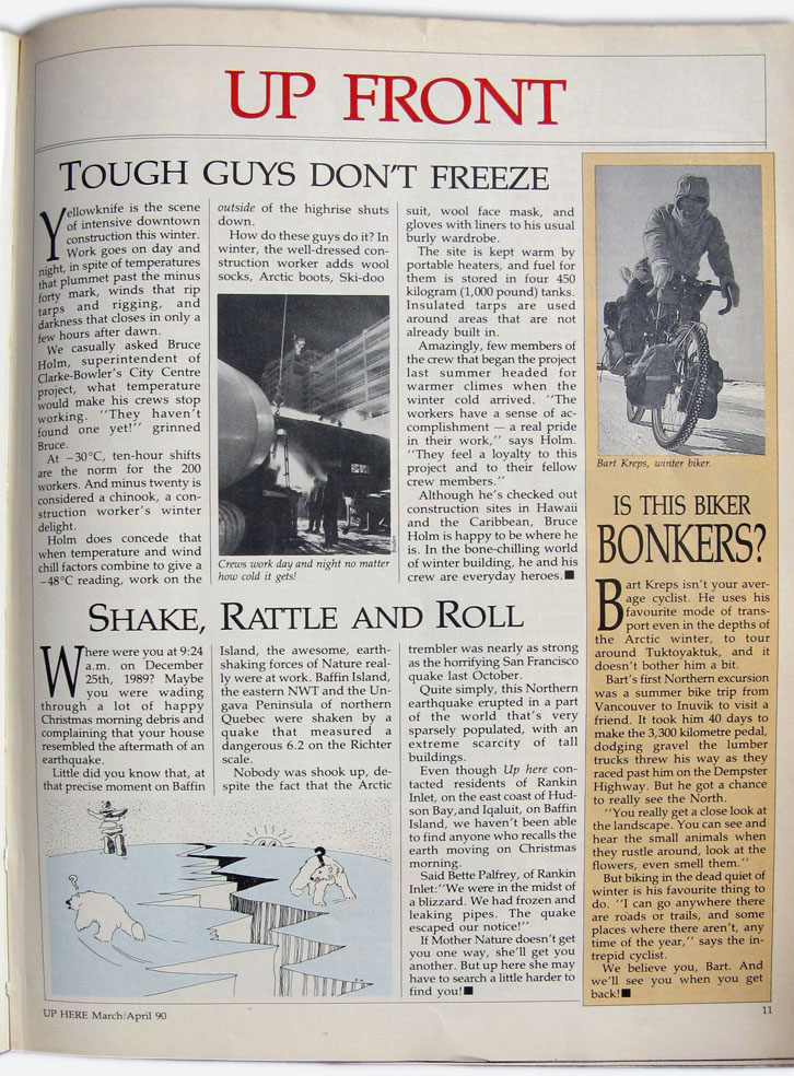
Originally published in 1989.

Like many long voyages, my trek to the tundra started with a few rash words over lunch in a Toronto restaurant.

“If you want to see the northwest, why don’t you try bicycling the Dempster Highway?’ a friend suggested. “Sure, why not,” I replied, and having committed myself, I eventually started researching the details. Like, where is the Dempster, and how do I get there?

Map drawn by Rebecca Barclay for NOW

Map drawn by Rebecca Barclay for NOW

The Dempster Highway, I learned, starts where the Yukon gold rush left off, winding 730 kilometres north from Dawson City, Yukon, to Inuvik, Northwest Territories – but “highway” is a rather generous term for this two-lane road without a square metre of pavement.

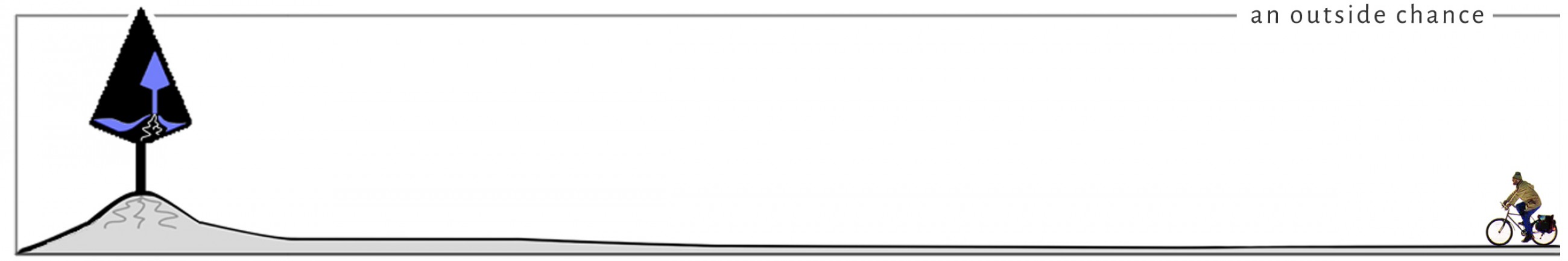
Still, the Dempster is the only public highway in North America to cross the Arctic Circle. If I wanted to pedal into the land of the midnight sun, this was my route.

So in the summer of 1988 I flew to Vancouver and started riding north, and 40 days later I reached the end of the road. For six weeks I watched the trees get shorter and the days longer, until both the forests and the night were gone.

The summer of ’88 was the coolest and wettest in memory in northern BC and the southern Yukon; for days on end the standard view was of dark, dripping mountains rising into low clouds. But when the sun did come out, revealing snowy peaks shining in the distance, I often had company to share the glory – the further north I got, the more cyclists I met.

Bikers, hikers, canoers and kayakers are all drawn to the Canadian northwest’s most precious asset – wilderness as pristine as any on earth. Within a few days of leaving Vancouver, it had become only natural to drink freely from rivers and streams.

Salmonberries on bushes four metres high in the coastal rain forests were followed by millions of pink roses lining the roads of northern BC. On the northern Yukon tundra, crowberries, blueberries and cloudberries were ripening one, two, sometimes ten centimetres above the mosses and lichens. These resources were seldom scarce, but on one occasion I thought it best to leave the berry patch to a bigger competitor.

*    *    *

There are two ways to go north from Vancouver towards the Yukon. An inland route goes northeast to Prince George. I opt instead for a ferry to Vancouver Island, three days pedalling to Port Hardy, and then an all-day cruise aboard the Queen of the North through the magnificent Inside Passage to Prince Rupert. This route not only saves a lazy cyclist at least 500 kilometres, but also offers a glimpse of westcoast wildlife. A pod of dolphins puts in an appearance beside the ferry, and bald eagles glide to perches on telephone poles in fishing villages. Seventy kilometres up the Skeena River from Prince Rupert I see a fat grey harbour seal swimming upstream after the salmon local anglers are trying unsuccessfully to catch. When I pull off the road, I find a quiet spot with a handy supply of red raspberries all around, but a few telltale signs persuade me to look for another campsite.

It isn’t just that a previous diner had trampled many of the thorny bushes. The territory is marked even more convincingly by a textbook example of ursine scat, bear shit so fresh that I detect a faint warmth rising from it. Since I won’t sleep very well with a bear prowling around my tent, I reluctantly get back in the saddle.

Just a few kilometres later I come to Exchamsiks River Provincial Park. Tonight is one of the few times I pay for the privilege of sleeping on a packed gravel pad designed for motorhomes. But in addition to an extra margin of safety provided by an attendant with a rifle, the park also offers a rare ambience – a towering stand of virgin spruce.

Nearly all the timber I’ve seen within 1000 kilometres of Vancouver has been logged at least once in the past century. So it’s worth six bucks to spend some time among Exchamsiks’ ancient trees.

Parks are few and far between in northern BC and the Yukon, but logging trucks also thin out. By the time I pass the Grand Canyon of the Stikine River, clear-cut hillsides are a rapidly fading memory. Spruce forests give way to lodgepole pine, and sightings of black bears, moose and otters liven up my days. On my first night in Yukon Territory, literally dozens of snowshoe hares scamper at roadside as I pedal towards a sunset the colour of fireweed.

The Southern Lakes district near Whitehorse is home to lots of artists, unreformed hippies and back-to-the-landers who have fled the cities of “the south.” Tagish Lake marks the halfway point of my journey, a place where I can impose myself on old friends, admire the view from an armchair, and catch up with my appetite. During five days in the area I eat bear, caribou and organic brown rice stew beside a canvas tipi occupied year round; I eat a salad of fresh garden greens and nasturtium petals while a wood fire heats rocks in a spacious sauna; I catch and eat my first arctic grayling, barely legal size but a tasty breakfast nevertheless; I eat mooseburgers at least once a day. Not until I get to Dawson, 650 kilometres northwest, will I strike such a rich vein again.

Dawson’s wealth was, of course, a flash in the pan. Within a couple of decades little gold was left for undercapitalized independents. Gargantuan dredges owned by far-away financiers, most notably New York’s Guggenheim family, swallowed up claims along Klondike River tributaries. The thirsty machines melted permafrost with water diverted from the Tombstone Mountains 110 kilometres distant, extracting glittering gold flakes and leaving five-metre-high piles of tailings snaking through once scenic valleys.

Today, with gold prices so high, a few independent operators have returned, working through tailings for the bit of gold that slipped through the sluices the first time. Recycling gold-rush history is also the stock-in-trade of a flourishing tourism industry.

Not many sightseers follow the Trail of ’98 in winter, so Dawson’s economy is seasonal. Bars, hotels and boutiques need lots of summer help. University students and world travellers in need of quick cash take many of the jobs, and not all of them want to spend their wages on rent.

I hear about the Squatters’ Village through the bicyclists’ grapevine. A fantastic array of shacks, treehouses and wall tents discretely hidden in dense forests on a steep slope, connected by footpaths and serviced by a clear cold brook, the village provides me a congenial home for a few days. Near the top of the hill I find an abandoned but still rainproof shack.

In the evenings I gather sticks, set up a grill outside my castle, and feast on the true treasure of the Klondike – king salmon.

King salmon swim 2,500 kilometres up the Yukon River from the Bering Sea to spawn in streams flowing into the Klondike. Many of the clean gravel creek beds where salmon once laid their eggs are silted up by goldmining dredges. But streams left alone for several decades are finally healing and again play host to spawning salmon.

Netted in nearby streams by native people, cleaned and sold the same day from coolers in Dawson’s back alleys, the pink-fleshed fish are a bargain at $2 a pound. The trick is to find one small enough for me and my dinner guest, a cyclist I had first met a week earlier. Served with steamed veggies and wonderful 12-grain bread from Nancy’s Bakery, the fresh-fish feast puts hungry bikers into a contented stupor.

*    *    *

Forty kilometres east of Dawson, where the Klondike River meets the Tintina Trench, a narrow strip of gravel heads north through the muskeg. From this intersection there isn’t another settlement until Eagle Lodge, a hotel-restaurant-gas station 363 kilometres up the road.

Native people have ventured here since time immemorial in search of mountain sheep and caribou. Archaeologists have found evidence of human activity in the northern Yukon in the middle of the last ice age, 25,000 years ago. But few white people travelled this area until recent decades, when prospectors began seismic exploration for oil and gas. In 1959 the Dempster Highway was begun to provide truck access to the resource-rich Mackenzie Delta, and the road reached Inuvik in 1979.

The Dempster traverses three remarkably contrasting mountain ranges. The southernmost Tombstone range escaped glaciation and its peaks jut jaggedly into the sky. The Ogilvies, only a day’s ride north, were flattened and rounded by glaciers; from a distance, the hills look like smooth concrete, but a short hike from the road puts a climber on slopes of shattered scree. The Richardsons, north of the Arctic Circle, are smooth, windswept, but green with grass, lichens and moss. All these ranges offer some easy climbs.

I cross the Arctic Circle at the north end of Eagle Plains, a long stretch of rugged hills. It’s mid-afternoon, and immediately the temperature starts to drop. I seek refuge in the cooking shelter at Cornwall River Territorial Campground. As I set up my tent and cook supper, the wind howls and rain falls in torrents; I’m happy to be in a wooded valley and not on the exposed high ground.

The storm abates and I get ready for an early night’s sleep, to no avail. Two lively commonwealthers join me – a hitchhiker from New Zealand and an Englishman hoping to lease a small claim and begin placer mining. When my entertaining companions finally go to sleep, it’s apparent the two are world-class snorers. One begins sawing logs, with a chain saw, while the other dreams of his gold mine – I can hear the dredge working full steam.

I crawl blearily out of my sleeping bag in the morning to find clear skies, strong northeast winds, and a temperature of 4°C. Wearing all the clothes I have with me, I start the long push over the Richardson Mountains against the chill breeze. I stop twice to cook a pot of cloudberry porridge in a vain attempt to keep up with my caloric output. Balmy weather returns as I coast down to the Peel River in the evening, but the arctic blast has served notice that winter is never far away in these parts.

For two more days I pedal in warm sunshine along the Mackenzie Delta, past scrub willow and three-metre-tall, century old spruce. It’s early August, the sun is setting about midnight, and twilight merges with dawn.
 

Published in NOW, Toronto, April 13, 1989

An uphill ride through Oklahoma

Originally published in 1987.

Travelling by car on gently graded Interstate 35, you barely notice the Arbuckle Mountains 100 kilometres south of Oklahoma City.

But traverse these mountains on bicycle on old U.S. 77, and you’ll have a wonderful introduction to Oklahoma’s hill country. Straight over the peaks you go, with no road cuts or fills to smooth the rugged topography. Cyclists who sentence themselves to a full day of pedalling these slopes will find it easy to empathize with the convicts who used human power to build Highway 77 back in the 1920s.

When you’re at large on two wheels, of course, there’s no need to put in a full day of hard labour. You can linger and enjoy your scenic rewards after every difficult climb. For travellers who’ve had their fill of the Southwest’s vast stretches of open plain, Oklahoma’s mountain ranges offer plenty of opportunities to change gears.

I pedalled into Oklahoma from the south in April, making my way from Dallas toward Kansas City, with the Arbuckles the first and only fixed point on my itinerary. The southernmost slopes of the Arbuckles were barren, severe – in place of vegetation, outcroppings of rock stretched to the horizon in straight and evenly spaced rows.

My initial impression of a vast desert graveyard was short-lived. When I reached the first summit a palette of colours lay before me. Slopes at one angle to the sun wore the dark green of cedar, others the soft green of new leaves on oak and elm, still others the dusty green of cactus and dry grass. Sandstone cliffs rose above slabs of grey granite, and wildflowers of spring grew among bushes still dressed in the flaming red of autumn.

Geologists tell us the Arbuckles are some of the oldest mountains on earth, and the range is certainly one of the smallest. Though the Arbuckles once towered almost as high as the Rockies, today the peaks rise only a few hundred metres from the surrounding plains. A cyclist can ride from one end of the range to the other in half a day, but with so much beauty and variety packed into such a small area, haste would be waste.

Turner Falls Park at the centre of the Arbuckles is a good place to set up camp for a day or two. Mountain springs merge in crystal-clear Honey Creek, cascading 25 metres to carve a swimming hole in the rock. Though souvenir shops and mini-train rides surround the park entrance, most of the 300 hectares of campground offer nothing more complicated than beautiful vistas, babbling brooks, and amenities such as picnic tables and washrooms.

I pitched my tent for two nights just a few metres from Honey Creek, half a kilometre above the falls. The deeper swimming areas were closed in early April, and locals were shocked at the idea of bathing in such frigid water. But to a Canadian who had climbed hills all day on bike and on foot in 25-degree sunshine, the shallow rushing waters of Honey Creek were a perfect whirlpool. (Yes, the water was cool, about like an Ontario lake near the end of a warm summer.)

After two days of crisscrossing the Arbuckles on back roads, my appetite for hill-climbing had just been whetted. I had lots of time, and the weather was perfect; I set out on a 250-kilometre detour through dusty ranch country to more and bigger mountains in eastern Oklahoma.

So it was that after two more days I found myself bouncing along a gravel road beside Jack Fork Mountain, 45 kilometres from any town, on a balmy Saturday evening. I had crossed the Indian Nation Turnpike on State Highway 43 at the former village of Daisy, only to find that the paved road shown on my map was really a winding stretch of potholes and loose rock. I wondered if I could still make another 35 kilometres to a public campground before dark, and then the delay of a flat tire removed all doubt.

As the road got narrower, the forest closed in on all sides, and little streams trickled out of the hills every kilometre. Here cattle grazed in small cleared pastures that were lush green. Cardinals flitted in the bushes beside the road, cottontail rabbits bounded in front of me.

I rode till just past 7 p.m., when I passed a clear creek just wide enough for a quick swim. I pulled into the next driveway to ask a rancher if I could camp on his land.

“There’s a real nice campsite just a mile up the road,” he answered. Yes, there was running water, he said, but no, I wouldn’t see a sign to announce the turn-off.

“You’ll see a dump right beside the road, and if you turn in there and go a hundred yards further, you’ll find a nice flat spot to pitch your tent. You might have company tonight – it’s turkey season, so there might be some hunters staying there.”

Visions of wild turkey roasting over an open fire certainly appealed to my empty stomach, and I rolled on. A few minutes later I came to a pile of rubbish. There was an old logging trail marked by a faded picture of Smoky The Bear and the barely legible words “Goforth Road.” I went forth past the dump into the woods, but met no hunting party.

There was running water, though – little springs and streams crossed the road every 100 metres. I pedalled another kilometre, then pitched my tent in a small clearing. A nearby brook had carved a little hollow in the sand, about half a metre deep. I hung my clothes on a tree, looked around warily for the cottonmouth snakes I had heard so many stories about, and lowered myself gingerly into a much-needed Saturday night bath.

By the time I had dressed for dinner and set up my stove on a smooth flat rock, stars were burning holes in a moonless sky. Tortillas, beans and canned okra by candlelight had to stand in for roast turkey, but the ambience of this inn was hard to beat. The night breeze was still warm, the air smelled of pine and wildflowers, the drone of insects was interrupted only by the high-pitched gobble of wild turkeys and a far-away chorus of coyotes.

Early the next morning I heard a four-wheel-drive truck lumbering along the trail. I stepped out of my tent and said hello to a friendly group of hunters. The driver looked curiously at my bicycle, tent and stove, and said, “You just sittin’ there listening to them turkeys gobble? I bet you’re havin’ a ball.”

I allowed as how April in the mountains of Oklahoma was mighty fine.

This article originally appeared in the Travel section of the Toronto Globe & Mail, 1987.

Fifteen minutes of fame

In my only experience of celebrity status, the Yellowknife-based magazine Up Here snapped a picture of me heading out on the ice road for a camping trip, and recognized me as “bonkers”. March, 1990

Up_Here_1990

From Up Here, Yellowknife, NT, March/April 1990


The Conquest of a Continent


A review of

The Conquest of a Continent

Siberia & The Russians

by W. Bruce Lincoln, Random House, 1994
Originally published in 1994

Siberia and Canada have much in common by way of geography and history. Europeans were first attracted to both regions by the lustrous furs to be taken in the taiga, tundra and boreal forests. In each case, trappers and traders soon proved it possible to deplete animal populations, even in seemingly limitless regions, unless attention was paid to conservation. In the ensuing centuries, prospectors in both countries found precious minerals, heavy metals, and petroleum in the most inhospitable of locations, spurring engineers to learn about permafrost, meltwater bogs, and shifting ice floes.

In both countries, colonizers have overwhelmingly clustered in a narrow band along the southern borders. Finally, the ways of the peoples who have made the northern lands their homes for millenia have been generally ignored by the newcomers.

If Siberians and Canadians have a great deal to learn from each other, there was little opportunity for contact for most of this century. But in the last few years, many Canadian companies with experience in resource extraction and arctic construction techniques have been welcomed in Siberia, while travelling delegations of native peoples have shared perspectives on preserving their cultures in an industrial age.

With these new opportunities for interchange, a familiarity with Siberia’s history is essential to many people. W. Bruce Lincoln’s new book tells part of this story ably, although Lincoln gives us only fleeting glimpses of the native peoples of Siberia, and almost no sense of how their cultures fare today or how they have contributed to Siberia’s history.

Lincoln’s opening sentence provides a controversial if succinct interpretation of history: “Nations are born of battle, and conquest makes them great.” The gory opening chapters on the Mongol armies, who exited history’s centre stage as quickly as they entered, may lead some readers to conclude that the book will equal the average action movie in its insights into the human condition.

Deeper into the book, however, Lincoln rounds out the story, even though the tales for the most part remain chilling. We learn about the slow progress of Siberian industry, as hundreds of thousands of workers carve railways through mountains and dig mineshafts in rock-hard permafrost. Lincoln weaves together many threads of political economy, to illustrate how the maneuverings of empire-building politicians in Europe often resulted in the starvation of prisoners thousands of miles away.

With only a few brief exceptions, each brutal regime seemed to beget an even more brutal regime, until the Bolsheviks, desperate to create an industrial colossus out of the reach of rival armies, sacrificed forced labourers by the hundreds of thousands. In the process, land and people suffered equally: “Siberia’s Soviet masters had transformed the fragile ecology of the tundra and taiga . . . into some of the most noxious surroundings on earth.” While Russia’s most recent rulers are seeking technical help to make Siberian industry more productive, the whole world, and especially the circumpolar countries, have an interest in helping Siberian industry clean up its act.

Lincoln’s book relates hundreds of tales of conquest in Siberia, but very little that could pass for greatness. With a lot of luck, perhaps the greatness will yet come.

Review originally published in the 150th Anniversary Edition of the Globe & Mail, March 5, 1994.

Canada Day on the Klondike

Canada Day on the Klondike

A father-&-son bike ride in the Yukon, 2008

Our campsite beside the Yukon River, at Carcross.

Our campsite beside the Yukon River, at Carmacks.

The sound of soft rain on our tent woke us on the morning of July 1st, and the showers continued long enough to make us consider staying right there beside the Yukon River. But by mid-afternoon the rain slowed to a drizzle, and we loaded our bikes and pedalled out of Carmacks, heading north on the Klondike Highway towards Dawson City.

Little did we guess that the day’s ride would last until midnight, and that we would be treated to an unconventional display of Canada Day fireworks.

The ride began, as usual, with a long ascent. (Most of the territorial campgrounds are located beside rivers, which in these parts always seem to be located at the bottom of valleys.) Our Canada Day climb soon had us comfortably warm in spite of the intermittent mists, and after an hour our muscles were limber and we were making good time. But the scenery proved too spectacular to allow us quick passage.

About 4 pm we reached the viewpoint for the Five Finger Rapids, justly billed as one of Yukon Territory’s most popular recreational attractions. The sun was beginning to emerge, and the strands of turbulent water glistened far below us. A rugged trail, which includes 230 steps in the Territory’s longest staircase, winds down to the shoreline for a close-up view of the massive outcrops of rock, dividing the river into five swift-flowing streams. Gulls and ravens appeared to have these islands to themselves, though interpretive signs explained that in years past, settlers had built a cable system from the shoreline to the rocks, so that paddlewheel steamboats could be winched safely through the rapids.

Five-Finger Rapids, Yukon River

Five-Finger Rapids, Yukon River

When we got back to our bikes at 5 pm, we had only ridden 25 kilometers, and Pelly Crossing, the next village, was still 80 km up the road. Knowing we had many hours of daylight left, we set out confidently for Pelly Crossing.

As the evening wore on, the wind picked up from the direction of the setting sun: north. We worked harder, and moved slower. When the sun dipped behind the mountains, the temperature dropped, bottoming out at 5°C. Every half hour we stopped to put on more clothes – wool tights over our shorts, then long-sleeve shirts, then wind-pants, then jackets, finally even our wool caps. After each stop we were warm for a few minutes, and after the next downhill cruise we were shivering again. At two of the stops we found wild strawberries growing beside the highway. The tiny and succulent specimens of rubus arcticus warmed our spirits, but did little to warm our aching joints.

Just after sunset, about 11:30 p.m., we came swooping down a curve right beside a large pond dotted with waterfowl. The birds were alarmed by something – perhaps our loaded bikes rattling down the bumpy road, perhaps the chattering of our teeth. The birds exploded up from the water, setting off a kind of reverse fireworks, with hundreds of fluttering black dots rising against the purple and pink light of the sky.

We reached Pelly Crossing after midnight, rolling into a large, well-equipped, and totally deserted campground. In the few minutes it took to crawl into our sleeping bags and fall asleep, we reflected that it had been a tough day, and one we would not have missed for the world.

Inuvik History

Inuvik History Project

In 2006 I was approached by Dick Hill, the first mayor and long-time resident of Inuvik, Northwest Territories, to work with him in transforming his extensive notes and photos into a history of the community. The result was a two-volume set published in July 2008 and launched at the community’s 50th Anniversary celebration.

My role included writing and editing, research in digital photo archives from Ottawa and Yellowknife, scanning and touch-up of photos and slides, design, layout, and liaison with the printer.

Inuvik: A History is approximately 240 pages, with a selection of photos, maps and illustrations in black and white. Inuvik In Pictures is 48 pages, with full colour pictures throughout.

Below: front and back cover of Inuvik: A History
Inuvik_History_Covers


Cover photographs for Inuvik: A History

Front Cover, top, Inuvik from the air, 1995, photo by Staffan Widstrand/Corbis; Olympic skiers Sharon & Shirley Firth, photo by Dick Hill; loading gravel at Twin Lake gravel pit, 1955, photo by Curt Merrill; RCMP officer Gerry Kisoun, photo by Raymond Gehman/Corbis. Back cover photographs show the ‘Ice Worm’ Carnival, 1960s, photo by Dr. Norris Hunt; and author Dick Hill.


Below: front and back cover of Inuvik In Pictures

Inuvik_Pictures_Covers


Cover photographs for Inuvik In Pictures:

Front Cover, top, raising the first large warehouse, 1956, photo by Curtis Merrill. Bottom left: Prime Minister and Mrs. Diefenbaker in Inuvik, 1961, NWT Archives. Bottom centre: civil servant housing, photo courtesy of Dr. N.E. Hunt Collection, Inuvik Centennial Library. Bottom right: Bill Nasogaluak at the Great Northern Arts Festival, 1992, photo by Tessa Mcintosh, NWT Archives.
Back Cover photographs: top row, left to right, Johnny Semple; Peggy Curtis; Nap Norbert; Cece McCauley; Rose Anne Allen. Second row, Cynthia Hill; unidentified; Martha Kupfer; unidentified. Third row, Billy Day, Doug Billingsley, Diane Baxter. Fourth row, Peter Clarkson, Victor Allen. Fifth row, Louis Goose.

The Arctic Grail

No oil slicks on the carpet, please

Launching Pierre Berton’s The Arctic Grail

Originally published in November, 1988

As photo opportunities go, the book launch for Pierre Berton’s The Arctic Grail was one of the most elaborate in publishing history. As arctic voyages go, the trip to a Beaufort Sea oil rig was somewhat less demanding than picking up Berton’s tome for an armchair expedition.

The Arctic Grail is an account of the romantic age of arctic exploration. Nineteenth-century audiences snapped up reports of their heroes fighting bitter blinding blizzards over vast uninhabited ice fields.

But a warm sun rose in a clear sky as two helicopters left Inuvik, 350 kilometres north of the Arctic Circle. As we flew north over the Mackenzie Delta, three-metre spruce gave way to one-metre scrub willow; soon we saw only lichens and lakes, and it seemed we were far from civilization.

The illusion was dispelled when we reached Tuktoyaktuk – Inuvialuktun* for “looks like caribou.” Herds of oil tanks flanked a winding shoreline, dwarfing the houses, the Catholic Church, even The Bay.

Berton closes his saga in 1909, when the motor age was just beginning. Eighty years later, prospectors are staking claims at the ends of the earth, oil companies are pumping gas from beneath the ice pack, and 20,000 horsepower icebreakers are making test runs through the Northwest Passage.

If thirst for petroleum sparked new interest in the north, it also made Berton’s book launch possible – the author and most of his entourage were escorted from Calgary by Gulf Canada Resources Limited. When the helicopters set us down on a deck 40 nautical miles from shore, our hosts began a tour of the Molikpaq oil rig.

Here came the day’s moment of high adventure – a crane lifted a dozen of us over the water to a tug boat. We stood on a swinging two-metre ring, clutching a rope rigging, while sparkling waves bobbed beneath us – more fun then the CNE**, and absolutely free. Gulf employees patiently followed photographers’ directions to put Berton in just the right position for the cameras.

Several hundred blinks of the shutter later the party was reunited in the dining hall, where we toasted our exploits with Carl Jung De-alcoholized Wine – the town of Tuktoyaktuk and Gulf’s northern facilities being “dry” zones.

Early explorers in Berton’s account were too stubborn to follow Inuit advice: “Could any proper Englishman traipse about in ragged seal fur, eating raw blubber and living in hovels made of snow?” They caught chills when their wool uniforms got sweaty, and suffered scurvy because they cooked the vitamins out of their meat.

As guests of Gulf we had no such worries. We filed past the fresh salad bar in stocking feet (no oil slicks on the carpet, please), and our musk-ox and caribou were served well-done.

Written during a stint as reporter for the Inuvik Drum, and published in NOW, Toronto, November 17, 1988.


* The original version stated “Inuktitut”, the more general name for Inuit languages, instead of “Inuvialuktun”, the language of the Inuvialuit of Canada’s western arctic region.

** CNE = Canadian National Exhibition, known to generations of Toronto youngsters for its amusement park rides.